 |
Hike #52 20 Sideroad Mulmur to BTC Parking Area 30 Sideroad Mulmur
We started today's hike at 20 Sideroad and Prince of Whales Road. Due to an injury I wasn't able to complete the hike. Instead, I drove to the pickup location and did the last couple of kms of the hike. Peter's brother Rob, who was visiting from Vancouver, filled in. It was hot and muggy, and the skeeters were biting! This is where I bug out and let Peter take over the blog writing. |
 |
| Roadside parking on Price of Whale Rd at 20 Sideroad (8 cars) |
 |
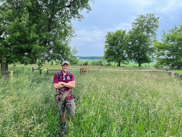
| Peter's brother Rob joins the hike! Peter sporting Marauders swag. |
The trail leaves Prince of Whales Road opposite 20 Sideroad, climbing along a gravel road towards the east. We spied some flora and fauna along the way. A small creek crossed the road via a culvert. At the top of the hill the trail leaves the gravel road as it turns north into the woods (approx 3km stretch). Here we found a BTC logbook and were followed for about 10 minutes a grouse (so cute!).
 |
| Gravel road (steady incline). |
 |
| Where the trail turns north to enter the woods. |
 |
| This stile was 10 meters from the road (heading west). |
 |
| Filling out BTC log book. |
 |
| Pretty sure this bird is a grouse. |
The trail continued about 3km's north. The woods gave way to farmer's field occupied by cows. We crossed several newly constructed stiles over electrified fences. A picnic area greeted us just before we re-entered the woods again.
 |
| View north through woods |
 |
| Testing the wires to see if they were AC or DC... |
 |
| A tool used to mend fencing. |
 |
| Clearly, the fence were not electrified today - the switch was open. |
 |
| View north along trail |
 |
| The black dots are cows (view to east) |
 |
| Picnic area at top of hill near edge of woods. |
The trail continued north through a copse of trees before exiting to farmer's fields yet again! Shortly after exiting the woods, two silos could be seen on the horizon. At the silos, the trail turn sharply east towards Prince of Whales Rd, where it turns south before crossing the road. There is road parking at both intersections of the trail with Prince of Whales Road (8 cars each). |
| Easy to miss trail marker at picnic area. The trail continues north through the woods. |
 |
| Trek north through the copse of trees. |
 |
| We exit from the woods into Farmer's fields. |
 |
| One of many stiles in this section of the trail (view eastward). |
 |
| Silos visible to north of trail. |
 |
| Series of stiles leading eastward. Entrance to woods in the distance. |
 |
| Section through woods that parallel Prince of Whales Road (heading south) |
 |
| View of Prince of Whales Road from the west side. |
 |
| View of Prince of Whales Road from the east side. |
After crossing Prince of Whales Rd, the trail continues eastward through woods to cross Center Rd. There is roadside parking at Center Rd (8 cars). |
| Clearly we found someone's thoughtful spot (or nappy time spot). |
 |
| View of Center Rd (northward) from the west-side. |
 |
| Where the trail enters on the opposite side of Center Rd. |
After crossing Center Rd, the trail descends through the Black Bank valley, where is crosses a large stream - a tributary of the Pine River. The trail continues to meanders north west towards Dufferin Rd 21, climbing back out of the river valley.
 |
| Trail descending valley towards river. |
 |
| View of bridge (from south) tributary of Pine River. |
 |
| View eastward across bridge. |
 |
| View northward from bridge. |
 |
| What goes down, must go up - our journey out of the river valley. |
 |
| An abandoned barn - spooky! |
 |
| Bridge crossing a small ravine. |
 |
| One of many pine plantations found in Ontario. |
 |
| A welcome rest spot for those climbing out of the Black Bank river valley. |
 |
| View of Durrerin Rd 21 from the south-side. |
 |
| View northward along Dufferin Rd 21. |
After crossing Dufferin Rd 21, the trail briefly heads north, then turns east for approximately 1.5 km, then turns north again to follow 1st Line EHS (a gravel road) through the woods towards 30 Sideroad. The junction of 1st Line EHS and 30 Sideroad was the terminus for our hike today - less than 3kms away from the Dufferin Hi-Lands and Blue Mountain sections!
 |
| Entrance of Bruce trail on the north-side of Dufferin Rd 21. |
 |
| We encountered a section of the woods that was thick with tall ferns. |
 |
| Top-down view of a fern. |
 |
| This is where the trail turns northwards from its easterly track. |
 |
| 1st Line EHS at this point is little more than an unimproved, pock-marked gravel road. |
 |
| Anyone in need of a range-stove? Electric model. Some wear and tear. |
 |
| The Black Edge side trail did not appear on our BTC trail map... |
 |
| Section of cedars encountered just south of 30 Sideroad. |
 |
| Shenanigans. What a cave man! |
 |
| We encountered Amanda in the woods just south of 30 Sideroad. |
 |
| Bridge over stream fed by waterfall encountered near 30 Sideroad. |
 |
| Amanda & Rob posing. |
 |
| Peter posing... |
 |
| Headwaters of waterall. |
 |
| View of waterfalls to north of bridge. |
 |
| The end is in sight! |
 |
| Trails end at 30 Sideroad and 1st Line EHS / East. |
 |
| A side trail leads to the parking area off of 30 Sideroad. This is accessed east of 1st Line just south of 30 Sideroad. |
 |
| View of parking area off of 30 Sideroad (south side, east of 1st Line EHS) |
Hike #52
Time: 3 hours 45 min
Distance: 12.2 kms (as per BTC map)
Difficulty: Moderate: rolling hills, meadows, steep climbs
Trail Use: Hiking Only
Total kms hiked: 380.6
Kms remaining: 531.3
Points of Interest in the Area: We didn't stop to visit any points of interest...


Comments
Post a Comment